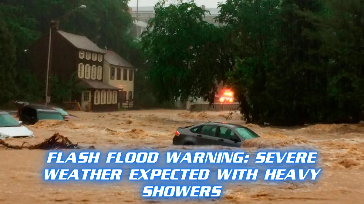
The region is in for a stretch of unsettled weather over the next few days, with storms, heavy rainfall, and gusty winds forecasted. Tonight, skies will remain mostly cloudy, with a 90% chance of showers and thunderstorms. Some areas could experience locally heavy downpours, raising the risk of flash flooding in low-lying regions. Temperatures will drop to a low of 67 degrees by the early morning hours.
Looking ahead to Friday, cloudy skies and strong winds will dominate the forecast. The likelihood of showers and thunderstorms remains high at 90%. Wind gusts could reach up to 65 mph, creating hazardous conditions, especially for drivers and those outdoors. The temperature will peak at 77 degrees. Along with the heavy rain, there is a significant risk of localized flooding, particularly in areas that have already seen substantial rainfall in recent days.
Friday night will bring a brief respite from the severe weather, with the chance of rain dropping to 30%. Scattered showers and thunderstorms may still be possible, and temperatures will cool down to a low of 60 degrees. However, the wet conditions are expected to continue into Saturday. The chance of rain increases slightly to 40% during the day, with scattered showers and a high temperature of 74 degrees.
By Saturday night, conditions will start to improve. Partly cloudy skies are forecast, though there will still be a 20% chance of scattered showers and thunderstorms. The low temperature will be around 60 degrees. Residents can expect a mix of partly cloudy and cloudy skies as the weekend progresses into Sunday, with another 50% chance of scattered showers and thunderstorms. The high will be around 73 degrees.
Sunday night and Monday will see a continuation of the cloudy, rainy trend. There’s a 40% chance of showers and thunderstorms Sunday night, and temperatures will dip to 57 degrees. Monday’s high is expected to reach 75 degrees under cloudy skies, with more showers likely as the week begins.
The rain and cloudy conditions will carry into Monday night and Tuesday, with more showers and thunderstorms in the forecast. Temperatures will hover around a low of 57 degrees at night, climbing to a high of 72 degrees by Tuesday. The chance of rain on Tuesday will be 30%, with scattered showers throughout the day.
The stormy pattern is expected to ease up slightly by mid-week. Scattered showers are still in the forecast for Wednesday, but the chance of rain drops to 20%. The afternoon high will remain cool at 72 degrees.
By Thursday, the region could finally see some clearer skies. Partly cloudy conditions are forecast with a high of 78 degrees, marking a potential end to the series of storms. However, forecasters warn that conditions could still change, and residents are advised to monitor updates closely.
The coming days will bring a mix of dangerous weather conditions, from heavy rain to strong winds, which may cause localized flooding and power outages. Residents should remain prepared, avoid flooded areas, and take precautions for high winds. It’s a good idea to keep emergency supplies on hand, as the weather system continues to move through the region.