Tropical Storm Helene continues to wreak havoc across the southeastern United States after making landfall late Thursday night. At 11:10 p.m. EDT on September 26, Helene struck the Florida coast about 10 miles west-southwest of Perry, Florida, as a powerful Category 4 hurricane with winds of 140 mph. The storm has since weakened to a tropical storm, but it still poses a significant threat as it moves inland.
As of Friday morning, Helene’s center was located about 80 miles east-northeast of Atlanta, Georgia, moving north at 30 mph with sustained winds of 60 mph. The National Weather Service has issued multiple warnings across Georgia, the Carolinas, and into southern Virginia, including flash flood and tornado watches.
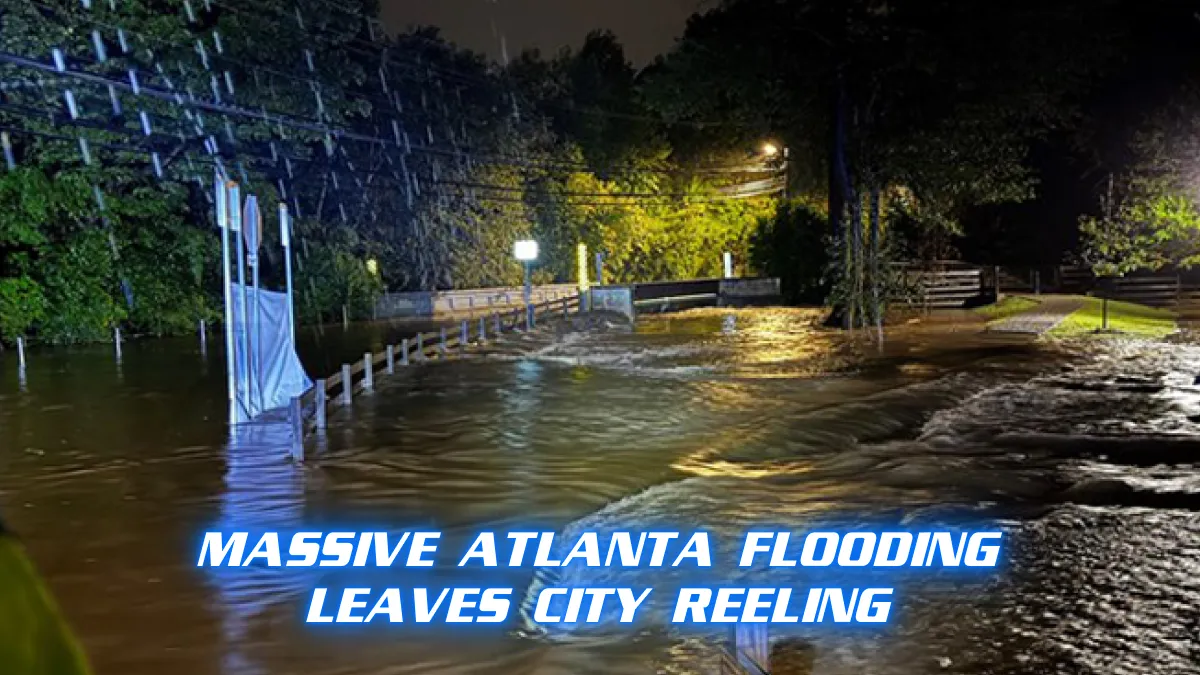
Georgia, particularly the metro Atlanta area, is facing serious flooding issues. There have been two high-end flash flood emergency warnings in Atlanta and several more across western North Carolina, especially in the Asheville area. In the past 48 hours, Helene has triggered nearly 200 reports of flooding from northern Florida to western Virginia.
Heavy rainfall, especially in the hilly and mountainous terrain of northern Georgia and the southern Appalachians, has created a dangerous situation. Floodwaters have been rising quickly, leading to catastrophic flash flooding and raising the risk of landslides. Some rivers are already approaching record levels, with major flooding expected in the region.
In addition to the flooding, high winds continue to batter the southeastern states. Tropical storm warnings remain in effect across parts of Georgia, South Carolina, and western North Carolina. Wind gusts as high as 90 mph were reported in southern Georgia on Friday morning, with cities like Valdosta and Alma among the hardest hit. Even as far north as Augusta, Georgia, wind gusts have reached 82 mph. These strong winds have brought down trees, power lines, and caused widespread power outages, leaving thousands without electricity.
The storm is also generating a significant tornado threat, particularly east of the storm’s center. NOAA’s Storm Prediction Center has issued a tornado watch for parts of eastern South Carolina, North Carolina, and southern Virginia. As Helene moves further inland, the risk of isolated tornadoes remains high throughout the day.
Helene’s journey began earlier this week when it formed as Tropical Storm Helene over the western Caribbean Sea on September 24. The storm intensified rapidly after crossing the southern Gulf of Mexico, reaching Category 4 status on September 26. By Thursday night, it made landfall in Florida’s Big Bend region, becoming the strongest hurricane ever recorded in that area, surpassing both 2023’s Hurricane Idalia and the 1896 Cedar Keys hurricane.
The damage from the storm surge has been significant, especially in the Tampa Bay area, where water levels surpassed previous records. Clearwater Beach saw an inundation of 6.7 feet above the average high tide, breaking the record previously held by the 1993 Superstorm, which had caused 4.02 feet of surge.
Residents in the storm’s path are urged to remain vigilant as Helene continues its northward trek. The combination of heavy rain, strong winds, and possible tornadoes means that dangerous conditions will persist throughout the day and into the weekend. Emergency response teams are actively working to assist those affected, but many areas remain unsafe for travel.
The National Weather Service has advised people in the affected regions to stay indoors and avoid flooded areas. With more rain expected in the coming days, especially in the southern Appalachians, residents should be prepared for additional flooding and potential landslides.
In response to the storm, numerous shelters have been set up for displaced residents, and utility companies are working around the clock to restore power. However, with widespread wind damage and ongoing flooding, it may take days for some areas to fully recover.
Helene’s impact is yet another reminder of the growing intensity of storms during the Atlantic hurricane season. In less than 13 months, three major hurricanes have made landfall in Florida’s Big Bend region, raising concerns about the vulnerability of coastal communities in this area.
As Helene continues to track northward, residents in its path are being urged to heed warnings and stay safe. The storm’s full impact is still unfolding, but early reports suggest that it could take weeks, if not months, for some of the hardest-hit areas to recover from the flooding, wind damage, and power outages.