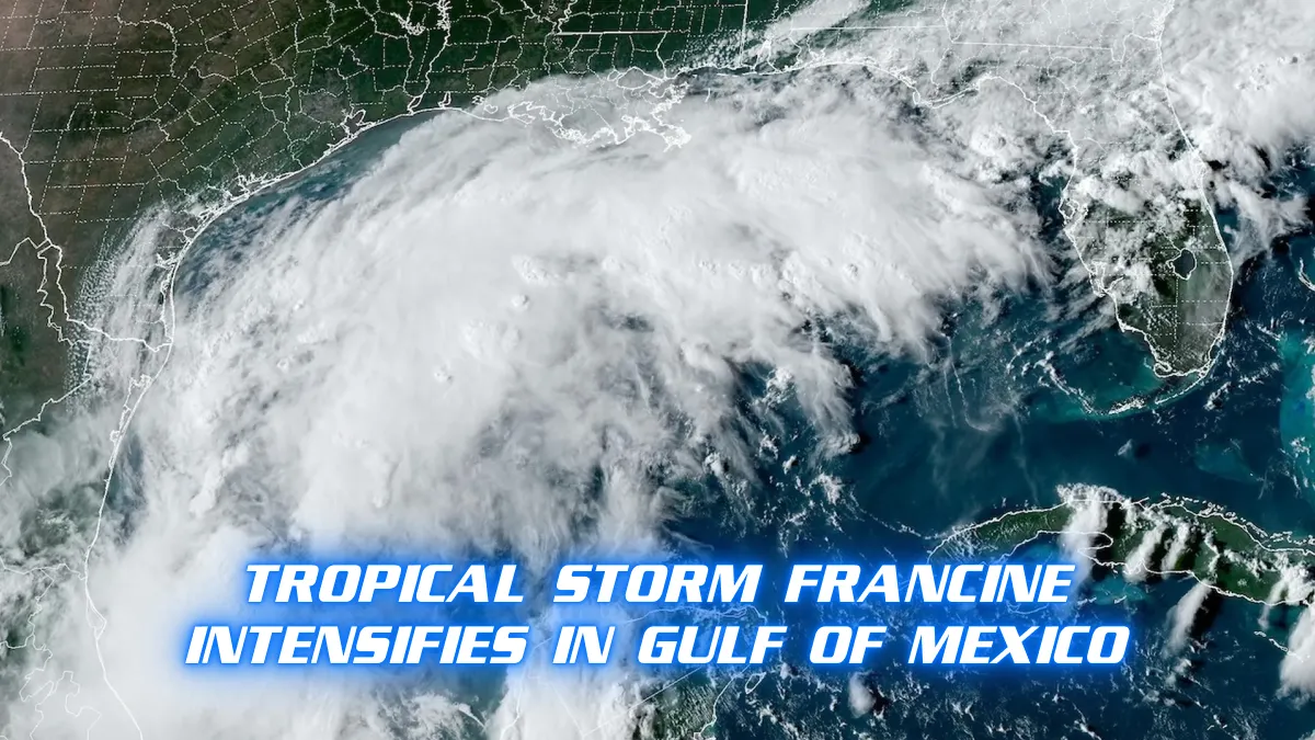
Tropical Storm Francine has formed in the Gulf of Mexico, according to weather authorities. On Monday, September 9, the storm was officially classified as a tropical storm by the National Hurricane Center (NHC). It is expected to bring heavy rain, strong winds, and rough seas to the surrounding coastal areas over the next few days.
The storm is currently moving in a north-northeast direction at a speed of around 15 miles per hour. Francine’s winds have already reached speeds of 45 mph, with further strengthening possible as it travels over the warm waters of the Gulf. Meteorologists are closely monitoring the storm’s path, and some models predict it could grow stronger before making landfall. Authorities in several coastal regions, including Louisiana, Mississippi, and Texas, are on high alert, with emergency plans being put into place.
Forecasters warn that tropical storms in the Gulf can quickly intensify due to the warm ocean temperatures and favorable weather conditions. Francine is the latest storm in what has been an unusually active hurricane season. Many communities in the Gulf region are still recovering from previous storms, and the formation of Francine has heightened concerns about flooding, storm surges, and power outages.
Local governments along the Gulf Coast have started issuing warnings and advisories to residents. Officials are urging people in low-lying areas to prepare for the possibility of evacuations. Flash flooding is a major concern, especially in areas that have already experienced heavy rains in recent weeks. The combination of storm surge and high tide could cause water levels to rise rapidly in certain coastal areas.
The NHC has noted that, while Francine’s current wind speeds classify it as a tropical storm, it is possible that the storm could strengthen further in the coming days. Warm waters in the Gulf act as fuel for tropical systems, and meteorologists will continue to assess whether Francine could intensify into a hurricane. However, even if the storm does not reach hurricane strength, it still poses a serious threat to the region.
Several oil platforms in the Gulf of Mexico have begun taking precautionary measures. Workers on some rigs have been evacuated as a safety precaution, and operations are being adjusted to account for the storm. The Gulf is home to a significant portion of the United States’ oil production, and storms in this region can sometimes lead to temporary disruptions in the energy supply chain.
Airlines have also started issuing travel advisories for flights to and from cities along the Gulf Coast. Delays and cancellations are expected as the storm approaches, and passengers are advised to check with their airlines for updates. The storm is also likely to affect marine traffic, with port authorities preparing for potential closures depending on Francine’s path and intensity.
Emergency response teams are mobilizing across the region. FEMA is coordinating with state and local governments to ensure that resources are in place if the storm leads to significant damage or disruption. First responders are preparing for the possibility of rescues and providing shelter to those who may be displaced by the storm.
In anticipation of Francine’s arrival, grocery stores in some areas are already seeing an increase in customers stocking up on supplies. Bottled water, batteries, and non-perishable food items are in high demand as residents brace for the storm. Some hardware stores are also reporting higher sales of generators and sandbags as people prepare their homes for potential flooding.
Tropical Storm Francine’s exact path remains uncertain, but it is expected to make landfall somewhere along the Gulf Coast by mid-week. The NHC will continue to issue updates and advisories as the storm progresses. Residents in the affected areas are urged to stay informed through local news outlets and official weather alerts. Coastal regions are expected to experience the brunt of the storm, but inland areas may also be impacted by heavy rains and strong winds.
This season has seen several tropical storms and hurricanes, and experts caution that the season is far from over. The peak of hurricane season typically occurs between August and October, meaning that more storms could potentially form in the coming weeks.
For now, all eyes are on Tropical Storm Francine as it churns through the Gulf of Mexico, potentially bringing significant disruption to coastal communities. With the storm still gaining strength, residents are being reminded to take the necessary precautions and to heed any evacuation orders that may be issued in the coming days.