
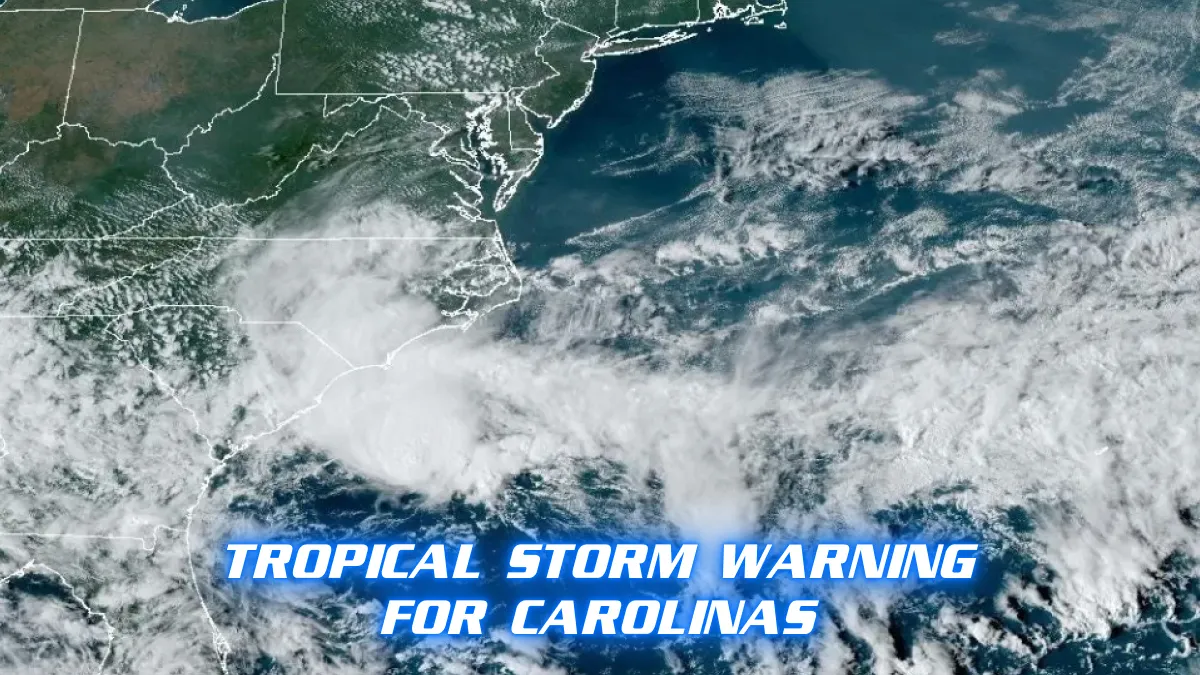
On Sunday, September 16, 2024, the Carolinas are under a tropical storm warning due to a low-pressure system swirling off the coast. This potential cyclone is expected to bring several days of high winds, heavy rainfall, and coastal flooding. The National Hurricane Center (NHC) issued the warning late Sunday night, signaling that the system could intensify into a tropical storm by Monday morning.
As of the NHC’s 11 p.m. Sunday advisory, the system was moving slowly east-southeast of Charleston, South Carolina, and south-southwest of Cape Lookout, North Carolina. It had sustained winds of 45 mph. Forecasters predict the system will approach the coast within the warning area on Monday and may become a tropical storm overnight or early Monday. There is also potential for the storm to strengthen further before landfall.
The National Weather Service (NWS) in Wilmington, North Carolina, has cautioned residents about the possibility of flash flooding due to excessive rainfall. The risk of flooding is particularly high for rivers, creeks, streams, and other low-lying areas prone to flooding. Rainfall totals are expected to reach 4-8 inches in many parts of North and South Carolina, with some areas potentially seeing up to 20 inches.
The NWS also warned of low-end tropical storm-force winds affecting the coast Sunday night, and the NHC has indicated that the storm may spawn isolated tornadoes across the eastern Carolinas on Monday. The storm is expected to cross over warm waters and the Gulf Stream, an area of relatively low wind shear, which could allow for further strengthening.
Coastal areas from South Carolina to North Carolina are under tropical storm warnings. The storm is forecasted to bring scattered flash and urban flooding, along with minor river flooding in some regions. The hurricane center also noted a risk of isolated flash and urban flooding extending into the Mid-Atlantic region through Wednesday.
AccuWeather reports that the heavy rain could begin as soon as Sunday night across parts of North Carolina, South Carolina, and Virginia. Coastal flooding, rip currents, and beach erosion are likely to impact areas from northeastern Florida up to Delaware. The risk of dangerous surf conditions and high tides, exacerbated by the full moon, could lead to minor to moderate coastal flooding early in the week.
In other storm updates, Tropical Storm Ileana weakened to a tropical depression on Sunday after making landfall near Cabo San Lucas, Mexico. It is expected to dissipate further by the end of the day. Tropical Depression Gordon, which had been a concern, lost strength and was downgraded to a tropical depression by 5 p.m. on Sunday, posing no threat to land.
As the potential tropical cyclone approaches, power production in the Gulf of Mexico remains disrupted. Over 16,000 homes and businesses in Louisiana are still without power four days after Hurricane Francine struck. The storm significantly impacted offshore oil and gas production, with nearly 20% of crude oil and 28% of natural gas output in U.S. Gulf federal waters still offline.
Forecasters are closely monitoring the system as it moves toward the Carolinas, where it could make landfall by late Monday near the North Carolina-South Carolina border. AccuWeather warns that the storm could drive gusts up to 80 mph, potentially leading to power outages and blocked access roads to barrier islands due to high water and erosion.
The Outer Banks of North Carolina are particularly vulnerable to dangerous rip currents, which are heightened by the storm. The weather service advises swimmers to avoid the water, as strong currents and dangerous shore breaks can pose serious risks, including injury.
This storm, described by AccuWeather as a “homegrown development,” is relatively rare. Most tropical systems during the hurricane season originate thousands of miles to the south over the central Atlantic before heading west. This system’s development so close to the coast is unusual but not unprecedented.
Residents in the Carolinas and surrounding areas are advised to stay informed about the latest weather updates and to prepare for potentially severe conditions as the storm continues to evolve.


